ds52.png
Dataset description:
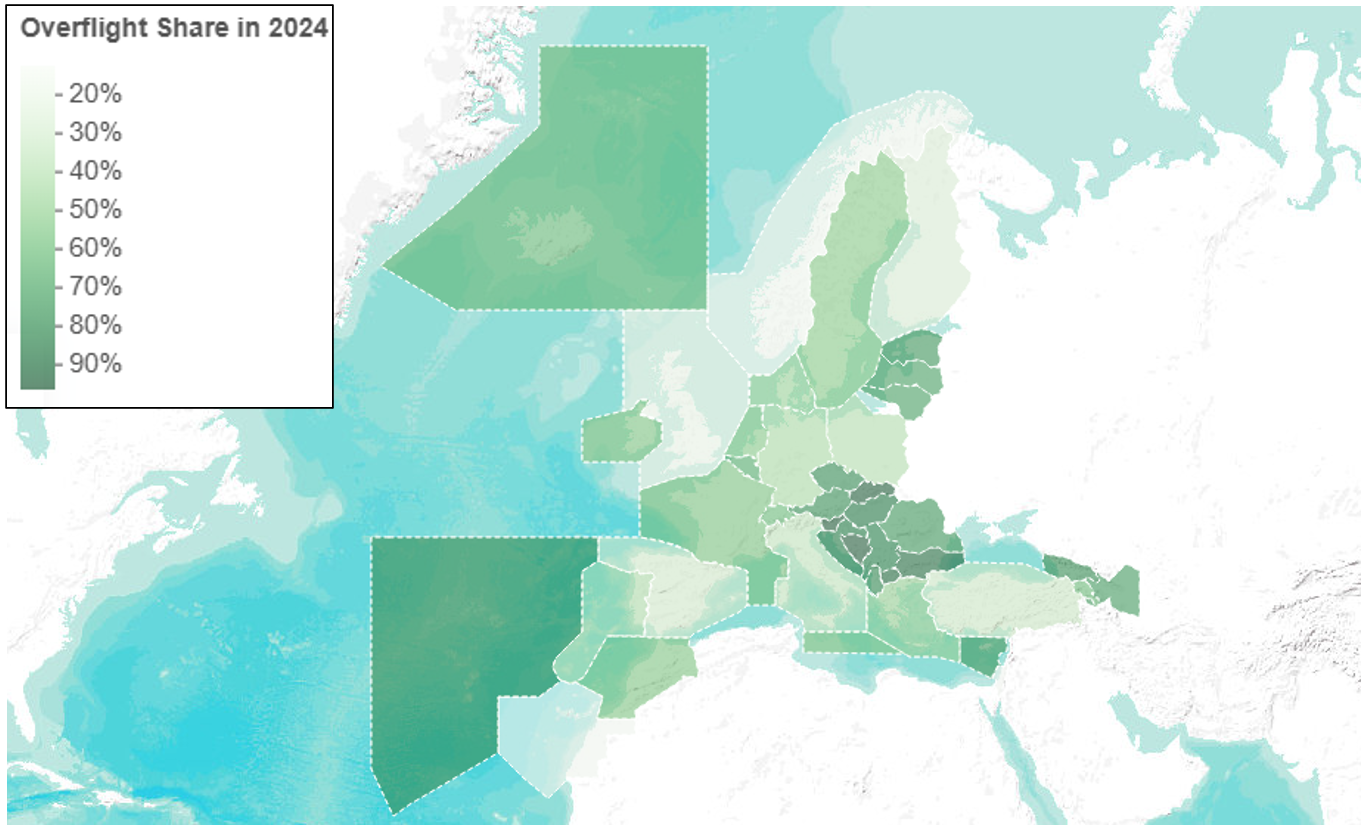
EUROCONTROL Data Snapshot examines how overflights vary across the network.
Source: Data Snapshot #52 - Which FIRs (Flight Information Regions) see the most overflights, and why?
Additional Information
| Field | Value |
|---|---|
| Data last updated | November 5, 2026 |
| Metadata last updated | November 5, 2026 |
| Created | November 5, 2026 |
| Format | PNG |
| License | EUROCONTROL data terms (cite the source, non-commercial) |
| API name | |
| Data from | |
| Data to | |
| Datastore active | False |
| Has views | True |
| Id | e8f65037-5a03-4cad-8abf-7ca593ca2e41 |
| Mimetype | image/png |
| Package id | 32b8f89e-2587-4b1d-a16d-141af4ef3906 |
| Polaris key | data-snapshot-52:image:ds52.png |
| Polaris role | image |
| Polaris sha256 | 0c18eae4d6ad4e9d013eb95b9af05692992c0aed8c09fd32ba9c1e33c67446e6 |
| Position | 3 |
| Size | 953.6 KiB |
| State | active |
| Url type | upload |